Activities
Marine

Every vessel, and the
VHF that guides them.

Ships announce themselves on AIS, call for help on DSC, and get their safety bulletins over NAVTEX. Airwave Scan decodes all of it — and keeps a listen on 406 MHz for the beacons that matter most.

AIS DSC distress NAVTEX 406 MHz EPIRB
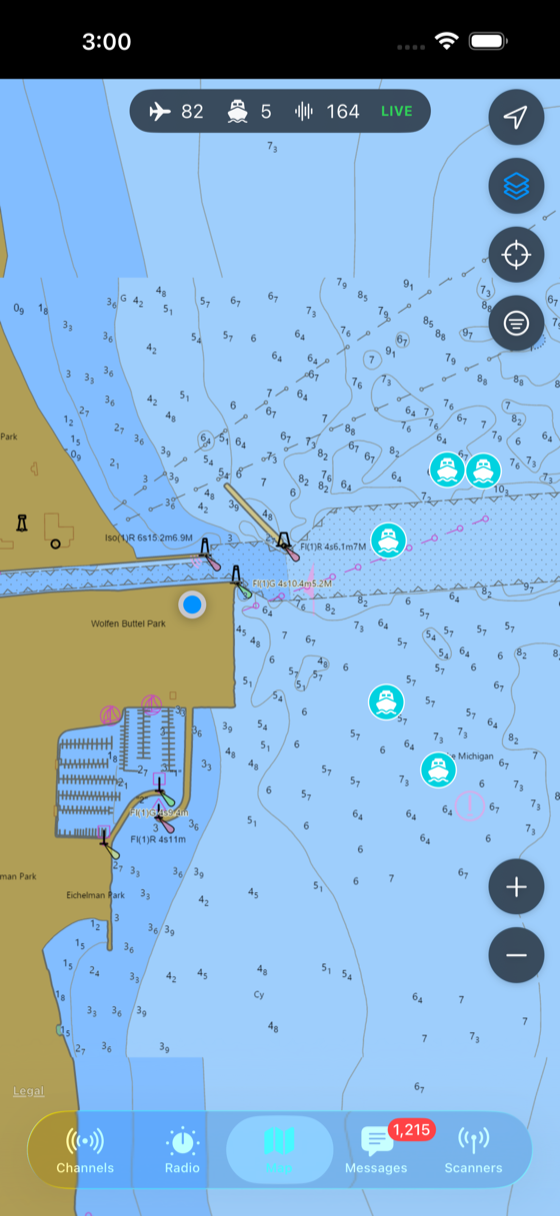
Five AIS ships tracked on the NOAA nautical chart off Kenosha Harbor
AIS

The harbor, plotted in real time

Decode the two AIS channels and every ship in VHF range appears on the map — moving, named, and one tap from its details.

  • Position, course & speed — vessels tracked live, colored by signal strength.
  • Name, type & destination — static and voyage data resolved per vessel.
  • Tap for the full picture — MMSI, dimensions, status and last update.
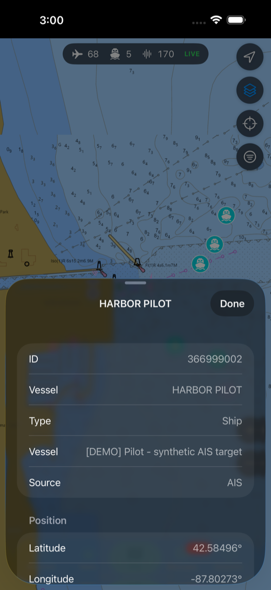
An AIS ship detail card — MMSI, vessel name, type, source and live position
Safety & distress

The calls you don't want to miss

Distress traffic gets decoded and pushed to the top — on VHF channel 70 and on the 406 MHz beacon band.

  • DSC distress — digital selective calling decoded, with the vessel and nature of distress.
  • 406 MHz beacons — EPIRB / PLB / ELT activations surfaced in the feed.
  • Alerts that stand out — distress and safety messages are flagged so they never scroll past unseen.
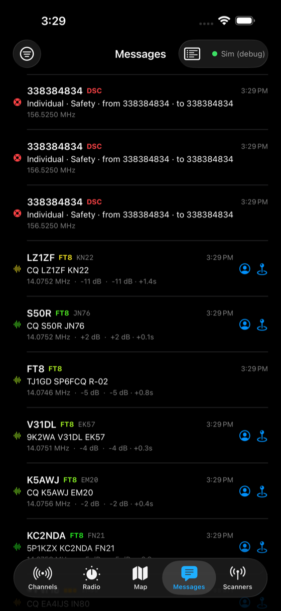
A real decoded DSC call in the feed — MMSI 338384834, Individual/Safety, on 156.525 MHz
Bulletins & weather

NAVTEX, marine VHF and the weather channels

The text bulletins and the voice channels that keep a passage safe, all in one app — plus the NOAA weather radio you'd want on any coast.

  • NAVTEX — 518 kHz maritime safety text: gale warnings, notices, forecasts.
  • Marine VHF voice — hailing, port operations and working channels from the catalog.
  • NOAA Weather Radio + SAME — continuous forecasts and decoded alert headers for your area.
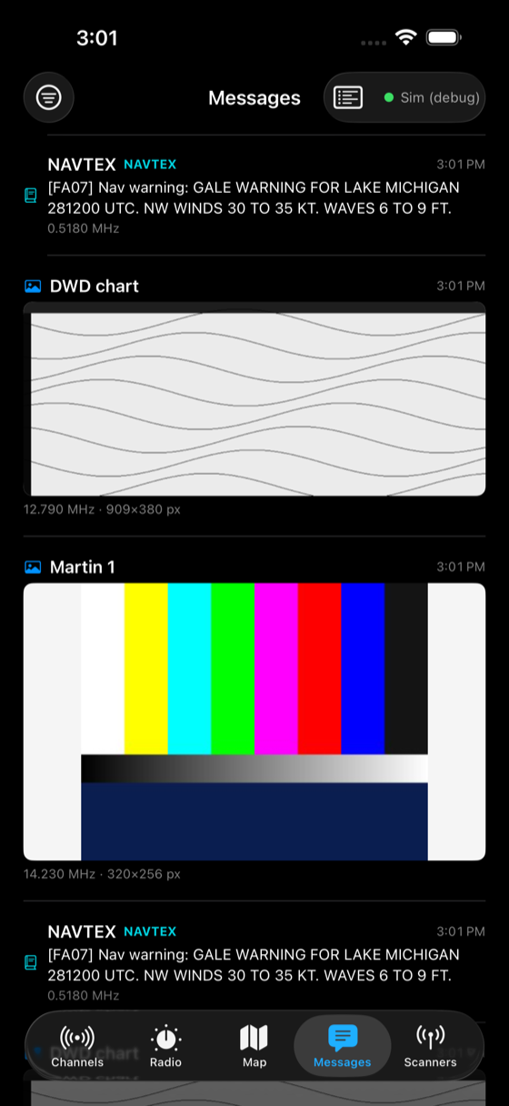
NAVTEX navigational warnings and weather-fax charts decoded into the feed

A quiet listen on 406 MHz

Emergency beacons key up rarely and briefly. The Pi can keep a dedicated ear on the 406 MHz band so an EPIRB or PLB activation lands in your feed the moment it transmits.

Get watching

A marine traffic & safety monitor

A VHF marine antenna and an RTL-SDR put the harbor on your map; add the NAVTEX and weather receivers on the same Pi.